Category:Isle of Man
Countries of the British Isles: Ireland · United Kingdom
UK constituent countries: England · Northern Ireland · Scotland · Wales
Crown dependencies: Guernsey‡ · Jersey‡ · Isle of Man
Islands: Alderney · Great Britain · Ireland · Jersey‡ · Isle of Man · Sark‡
‡: Sometimes considered part of the British Isles
UK constituent countries: England · Northern Ireland · Scotland · Wales
Crown dependencies: Guernsey‡ · Jersey‡ · Isle of Man
Islands: Alderney · Great Britain · Ireland · Jersey‡ · Isle of Man · Sark‡
‡: Sometimes considered part of the British Isles
historic nation and a self-governing British Crown dependency  someja satełitar in agosto    | |||||
| Upload media | |||||
| Instance of | |||||
|---|---|---|---|---|---|
| Part of |
| ||||
| Patron saint |
| ||||
| Location | Irish Sea | ||||
| Capital | |||||
| Legislative body | |||||
| Executive body | |||||
| Official language | |||||
| Anthem | |||||
| Currency | |||||
| Head of state |
| ||||
| Head of government |
| ||||
| Inception |
| ||||
| Highest point | |||||
| Population |
| ||||
| Area |
| ||||
| Top-level Internet domain | |||||
| Different from | |||||
| official website | |||||
 | |||||
Subcategories
This category has the following 16 subcategories, out of 16 total.
Pages in category "Isle of Man"
This category contains only the following page.
Media in category "Isle of Man"
The following 200 files are in this category, out of 373 total.
(previous page) (next page)-
 29.07.17 Groudle No.21 (36313934445).jpg 5,953 × 3,629; 13.48 MB
-
 8 Nation Pan-Celtic Flag.svg 2,360 × 1,560; 115 KB
-
 A Fence past its Best Before Date - geograph.org.uk - 5346956.jpg 640 × 424; 81 KB
-
 A grey day at Carrick Bay - geograph.org.uk - 8183876.jpg 1,024 × 685; 100 KB
-
 A stiff breeze today - geograph.org.uk - 3850095.jpg 640 × 480; 56 KB
-
 A Stream Across The Beach - geograph.org.uk - 6122443.jpg 1,024 × 678; 148 KB
-
 A Stream Near Jurby Head - geograph.org.uk - 6122480.jpg 678 × 1,024; 205 KB
-
 A Stream Reaches the Sea - geograph.org.uk - 6122429.jpg 1,024 × 678; 172 KB
-
 Abandoned Boiler along Tram Line - panoramio.jpg 3,648 × 2,736; 2.91 MB
-
 Abandoned Structure at Cronk y Cliwe - geograph.org.uk - 6121765.jpg 1,024 × 678; 151 KB
-
 Aldrick Bay - geograph.org.uk - 8035096.jpg 1,024 × 684; 205 KB
-
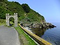 Arch to former tramway - geograph.org.uk - 3620657.jpg 640 × 480; 98 KB
-
 Baie Doo and Ooigyn Dhoo - geograph.org.uk - 1825087.jpg 800 × 600; 183 KB
-
 Bay ny Carrickey (or Gansey Bay) - geograph.org.uk - 5550994.jpg 2,592 × 1,944; 1.03 MB
-
 Bay ny Carrickey - geograph.org.uk - 7505564.jpg 1,024 × 731; 1.04 MB
-
 Bay ny Carrickey - geograph.org.uk - 7507960.jpg 1,024 × 731; 1.07 MB
-
 Bay ny Carrickey - the eastern shoreline - geograph.org.uk - 4874601.jpg 5,184 × 3,888; 5.36 MB
-
 Bay Stacka - geograph.org.uk - 4824527.jpg 640 × 480; 97 KB
-

-

-

-

-

-
 Beach and Ramsey Bay - geograph.org.uk - 3620008.jpg 1,920 × 1,276; 583 KB
-
 Beach at Kirk Michael - geograph.org.uk - 6290927.jpg 1,024 × 683; 185 KB
-
 Beach at Orisdale Head - geograph.org.uk - 6122068.jpg 1,024 × 678; 147 KB
-
 Beach below Orrisdale Head - geograph.org.uk - 2145487.jpg 1,024 × 768; 105 KB
-
 Beach by Cronk y Scottey - geograph.org.uk - 4821987.jpg 640 × 480; 65 KB
-
 Beach, Carrick Bay - geograph.org.uk - 8053575.jpg 1,024 × 684; 192 KB
-
 Beach, Carrick Bay - geograph.org.uk - 8059105.jpg 1,024 × 684; 173 KB
-
 Beach, Castletown Bay - geograph.org.uk - 8103964.jpg 1,024 × 684; 132 KB
-
 Bee Gees Birthplace.jpg 3,648 × 2,736; 3.22 MB
-
 Beware Green Rocks^ - geograph.org.uk - 7505550.jpg 1,024 × 731; 997 KB
-
 Boat to Isle of Man. Irish Sea (050230) (9453726762).jpg 1,604 × 2,330; 1.24 MB
-
 Bond Bug & Classic Cars.jpg 5,184 × 3,456; 6.55 MB
-
 Bond Cars badge.jpg 3,570 × 2,677; 1.82 MB
-
 Boulder Eroding Out Of The Cliff - geograph.org.uk - 5346925.jpg 424 × 640; 96 KB
-
 Boulder ^ Beach - geograph.org.uk - 5346879.jpg 424 × 640; 63 KB
-
 Boulders on The Beach - geograph.org.uk - 5346903.jpg 424 × 640; 86 KB
-
 Brachiopod Fossil - geograph.org.uk - 7507976.jpg 1,024 × 732; 1.11 MB
-
 Brewery Beach - geograph.org.uk - 8048035.jpg 1,024 × 684; 109 KB
-
 Brewery Beach - geograph.org.uk - 8058800.jpg 1,024 × 684; 192 KB
-
 Brewery Beach - geograph.org.uk - 8058810.jpg 1,024 × 684; 175 KB
-
 Brewery Beach - geograph.org.uk - 8058826.jpg 1,024 × 684; 148 KB
-
 Brewery Beach - geograph.org.uk - 8058835.jpg 1,024 × 684; 111 KB
-
 Brewery Beach - geograph.org.uk - 8058849.jpg 1,024 × 684; 96 KB
-
 Brewery Beach - geograph.org.uk - 8058858.jpg 1,024 × 684; 113 KB
-
 Bridge on the old mine road - panoramio.jpg 4,320 × 3,240; 4.27 MB
-
 Burroo Ned and Spanish Head - geograph.org.uk - 5696688.jpg 1,620 × 1,080; 498 KB
-
 Cammag Sticks.jpg 3,448 × 4,592; 8.83 MB
-
 Caninid Coral - geograph.org.uk - 7505556.jpg 1,024 × 731; 1.01 MB
-
 Carrick Bay - geograph.org.uk - 7647083.jpg 1,024 × 768; 184 KB
-
 Carrick Bay - geograph.org.uk - 8053577.jpg 1,024 × 684; 118 KB
-
 Carrick Bay - geograph.org.uk - 8059189.jpg 1,024 × 684; 214 KB
-
 Carrick Bay - geograph.org.uk - 8059201.jpg 1,024 × 684; 200 KB
-
 Carrick Bay - geograph.org.uk - 8059219.jpg 1,024 × 685; 156 KB
-
 Carrick Bay - geograph.org.uk - 8059230.jpg 1,024 × 684; 176 KB
-
 Castle from Fenella Beach, Peel - panoramio.jpg 3,008 × 2,000; 758 KB
-
 Castle of Refuge (15224787419).jpg 2,000 × 1,275; 3.35 MB
-
 Castle street in peel.jpg 1,536 × 2,048; 1.02 MB
-
 Castletown Beach - geograph.org.uk - 8139633.jpg 1,024 × 684; 173 KB
-
 Castletown Beach - geograph.org.uk - 8139634.jpg 1,024 × 684; 186 KB
-
 Castletown Beach - geograph.org.uk - 8139639.jpg 1,024 × 684; 204 KB
-

-
 Citroen 2CV in red.jpg 5,184 × 3,456; 5.74 MB
-
 Clay Head - geograph.org.uk - 1814342.jpg 800 × 600; 152 KB
-
 Cliff Fall Below Cronk ny Arry Lhaa - geograph.org.uk - 6122494.jpg 1,024 × 678; 169 KB
-
 Cliff just south of The Clett - geograph.org.uk - 1819616.jpg 800 × 600; 184 KB
-
 Cliff scenery near Ballavarane - geograph.org.uk - 1819603.jpg 800 × 600; 157 KB
-
 Cliffs and beach looking towards Shellag Point - geograph.org.uk - 3620012.jpg 1,920 × 1,276; 494 KB
-
 Cliffs and Cove North of Traie Cronkan - geograph.org.uk - 6123134.jpg 1,024 × 678; 166 KB
-
 Cliffs just north of The Clett rock - geograph.org.uk - 1814379.jpg 800 × 600; 196 KB
-
 Cliffs near Shellag Point - geograph.org.uk - 2145539.jpg 1,024 × 768; 173 KB
-
 Cmglee Douglas Isle of Man aerial view.jpg 3,200 × 4,800; 2 MB
-
 Coastal cliffs north of Traie ny Unaig - geograph.org.uk - 1815786.jpg 800 × 600; 170 KB
-
 Coastal scenery near Ballakilley Farm - geograph.org.uk - 1819613.jpg 800 × 600; 177 KB
-
 Coastline near the Keristal - geograph.org.uk - 3636128.jpg 640 × 480; 85 KB
-
-
 Coastline view from near Keristal - geograph.org.uk - 5779437.jpg 427 × 640; 85 KB
-
 Collapsing cliffs near Cronk ny Arrey Laa - geograph.org.uk - 3620019.jpg 1,600 × 1,657; 774 KB
-
 Concrete Eroded From the Cliff - geograph.org.uk - 6122208.jpg 1,024 × 678; 146 KB
-
 Concrete On The Beach - geograph.org.uk - 6122463.jpg 1,024 × 678; 218 KB
-
 Concrete on the Beach Below Jurby Head - geograph.org.uk - 6122451.jpg 1,024 × 678; 167 KB
-
 Cor Stack - geograph.org.uk - 1822252.jpg 800 × 600; 193 KB
-
 Cor Stack - geograph.org.uk - 1822268.jpg 800 × 600; 155 KB
-
 Creg Liauyr - geograph.org.uk - 8035320.jpg 1,024 × 684; 214 KB
-
 Creg y Jaghee - geograph.org.uk - 8028030.jpg 1,024 × 684; 138 KB
-
 Cronk y Scottey Beach - geograph.org.uk - 6121724.jpg 1,024 × 678; 157 KB
-
 Cronkbreck, dunes - geograph.org.uk - 4619505.jpg 1,024 × 768; 226 KB
-
 Crosh Cuirn.jpg 4,478 × 3,362; 5.23 MB
-
 Crumbling clay at Shellag Point - geograph.org.uk - 3617160.jpg 1,920 × 1,278; 489 KB
-
 Crux Guriat Cross Slab inscription.svg 416 × 402; 13 KB
-
 Crux Guriat Cross Slab.png 327 × 604; 253 KB
-
 Departing Douglas - panoramio.jpg 4,320 × 3,240; 3.47 MB
-
 Dhoon Bay - geograph.org.uk - 1832543.jpg 800 × 600; 138 KB
-
 Dhoon Beach - geograph.org.uk - 4905744.jpg 640 × 424; 67 KB
-
 Dismembered Crab - geograph.org.uk - 6121732.jpg 1,024 × 678; 233 KB
-
 Douglas - Harbour, promenades from Onchan Head - geograph.org.uk - 1676733.jpg 3,492 × 1,201; 2.77 MB
-
 Douglas Transmission station.jpg 133 × 100; 3 KB
-
 Down the Hillside - panoramio.jpg 3,648 × 2,736; 2.55 MB
-
 Drift Wood and The Ayres Beach - geograph.org.uk - 6121496.jpg 678 × 1,024; 201 KB
-
 Driftwood on The Beach Near Cronk ny Arry Lhaa - geograph.org.uk - 6122500.jpg 688 × 1,024; 209 KB
-
 Dry Stone Fences north of Dhoon Glen - panoramio.jpg 3,648 × 2,736; 2 MB
-
 Dusk approaching on the shoreline - geograph.org.uk - 6301615.jpg 1,600 × 1,200; 624 KB
-
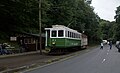
 Electric Tram Car - panoramio.jpg 3,240 × 4,320; 3.13 MB
-
 Eroded rocks - geograph.org.uk - 3620013.jpg 1,920 × 1,276; 815 KB
-
 Eroding Cliff Near The Cronk - geograph.org.uk - 6122302.jpg 1,024 × 678; 156 KB
-
 Eroding Foundations on The Cliff - geograph.org.uk - 6122219.jpg 678 × 1,024; 155 KB
-
 Fields near the railway - geograph.org.uk - 3136442.jpg 3,648 × 2,736; 1.86 MB
-

-

-

-
 Fitislaubsänger Isle of Man.jpg 566 × 848; 529 KB
-
 Footprints in The Sand - geograph.org.uk - 6121803.jpg 678 × 1,024; 187 KB
-
 Ford Focus illa de Man.jpg 1,800 × 1,151; 1.42 MB
-
 Foreshore, Carrick Bay - geograph.org.uk - 8059226.jpg 1,024 × 684; 264 KB
-
 Geo - geograph.org.uk - 8028039.jpg 1,024 × 684; 144 KB
-
 Geo - geograph.org.uk - 8028043.jpg 1,024 × 684; 234 KB
-
 Gian Wooar - geograph.org.uk - 1832603.jpg 800 × 600; 178 KB
-
 Gob ny Garvain - geograph.org.uk - 1815825.jpg 800 × 600; 135 KB
-
 Gob ny Garvain - geograph.org.uk - 1815862.jpg 800 × 600; 149 KB
-
 Gob ny How - geograph.org.uk - 1815309.jpg 800 × 600; 207 KB
-
 Gob ny Rona - geograph.org.uk - 1832770.jpg 800 × 600; 146 KB
-
 Gob ny Rona - geograph.org.uk - 1832775.jpg 800 × 600; 142 KB
-
 Gob ny Stroma - geograph.org.uk - 1822647.jpg 800 × 600; 169 KB
-
 Great Britain private parcel service stamps - 4.jpg 2,165 × 1,269; 345 KB
-
 Harbour Seal and Pup, Calf Sound - geograph.org.uk - 8166278.jpg 1,024 × 767; 239 KB
-
 Harbour Seal Swimming at Calf Sound - geograph.org.uk - 8166289.jpg 1,600 × 1,200; 281 KB
-
 High Tide at Cronk y Scottey - geograph.org.uk - 6121694.jpg 1,024 × 678; 159 KB
-
 Igneous Dyke - geograph.org.uk - 7507966.jpg 731 × 1,024; 1.02 MB
-
 Isle Of Man (181106699).jpeg 2,048 × 1,546; 626 KB
-
 Isle Of Man (181106701).jpeg 2,048 × 1,538; 344 KB
-
 Isle Of Man (181106703).jpeg 2,048 × 1,544; 856 KB
-
 Isle Of Man (181106727).jpeg 2,048 × 1,460; 665 KB
-
 Isle Of Man (181106733).jpeg 2,048 × 1,536; 664 KB
-
 Isle Of Man (181106737).jpeg 2,048 × 1,536; 664 KB
-
 Isle Of Man (181106739).jpeg 1,932 × 1,452; 436 KB
-
 Isle Of Man (181106741).jpeg 2,048 × 1,536; 1.12 MB
-
 Isle Of Man (181106745).jpeg 2,048 × 1,536; 1.34 MB
-
 Isle Of Man (181106763).jpeg 2,048 × 1,536; 1.56 MB
-
 Isle Of Man (181106765).jpeg 2,048 × 1,536; 1.54 MB
-
 Isle Of Man (181106769).jpeg 2,048 × 1,532; 1,003 KB
-
 Isle Of Man (181106771).jpeg 2,048 × 1,536; 1.1 MB
-
 Isle Of Man (181106773).jpeg 2,048 × 1,524; 1,012 KB
-
 Isle Of Man (181106781).jpeg 2,048 × 1,536; 1.04 MB
-
 Isle Of Man (181106785).jpeg 1,600 × 1,200; 201 KB
-
 Isle Of Man (181106789).jpeg 2,048 × 1,524; 1.17 MB
-
 Isle Of Man (181106859).jpeg 2,048 × 1,535; 957 KB
-
 Isle of Man - panoramio (10).jpg 4,320 × 3,240; 5.92 MB
-
 Isle of Man - panoramio (11).jpg 4,320 × 3,240; 3.63 MB
-
 Isle of Man - panoramio (12).jpg 4,320 × 3,240; 4.41 MB
-
 Isle of Man - panoramio (13).jpg 4,320 × 3,240; 4.86 MB
-
 Isle of Man - panoramio (14).jpg 4,320 × 3,240; 3.84 MB
-
 Isle of Man - panoramio (15).jpg 4,320 × 3,240; 3.77 MB
-
 Isle of Man - panoramio (16).jpg 4,320 × 3,240; 3.34 MB
-
 Isle of Man - panoramio (17).jpg 4,320 × 3,240; 6.2 MB
-
 Isle of Man - panoramio (18).jpg 4,320 × 3,240; 2.7 MB
-
 Isle of Man - panoramio (25).jpg 4,320 × 3,240; 3.98 MB
-
 Isle of Man - panoramio (26).jpg 4,320 × 3,240; 4.61 MB
-
 Isle of Man - panoramio (27).jpg 4,320 × 3,240; 4.14 MB
-
 Isle of Man - panoramio (28).jpg 4,320 × 3,240; 5.06 MB
-
 Isle of Man - panoramio (29).jpg 4,320 × 3,240; 4.39 MB
-
 Isle of Man - panoramio (31).jpg 4,320 × 3,240; 5.88 MB
-
 Isle of Man - panoramio (32).jpg 4,320 × 3,240; 5.61 MB
-
 Isle of Man - panoramio (33).jpg 4,320 × 3,240; 6.86 MB
-
 Isle of Man - panoramio (39).jpg 4,320 × 3,240; 4.55 MB
-
 Isle of Man - panoramio (40).jpg 4,320 × 3,240; 3.67 MB
-
 Isle of Man - panoramio (41).jpg 4,320 × 3,240; 3.49 MB
-
 Isle of Man - panoramio (5).jpg 3,240 × 4,320; 4.85 MB
-
 Isle of Man - panoramio (51).jpg 3,648 × 2,736; 1.91 MB
-
 Isle of Man - panoramio (53).jpg 3,648 × 2,736; 2.13 MB
-
 Isle of Man - panoramio (55).jpg 3,648 × 2,736; 2.73 MB
-
 Isle of Man - panoramio (59).jpg 4,176 × 2,784; 4.56 MB
-
 Isle of Man - panoramio (60).jpg 4,176 × 2,784; 5.01 MB
-
 Isle of Man - panoramio (74).jpg 4,320 × 3,240; 4.25 MB
-
 Isle of Man - panoramio (77).jpg 4,320 × 3,240; 4.13 MB
-
 Isle of Man - panoramio (78).jpg 3,648 × 2,736; 1.79 MB
-
 Isle of Man - panoramio (83).jpg 3,648 × 2,736; 2.74 MB
-
 Isle of Man - panoramio (86).jpg 4,176 × 2,784; 4.6 MB
-
 Isle of Man - panoramio (95).jpg 2,592 × 1,936; 2.4 MB
-
 Isle of Man - panoramio.jpg 3,008 × 2,000; 736 KB
-
 Isle of Man Coast towards Calf of Man (7965375506).jpg 2,592 × 1,944; 1.79 MB
-
 Isle of Man Coast towards Calf of Man (7965385588).jpg 2,592 × 1,944; 1.75 MB
-
 Isle of Man Coast towards Port Erin (7965393004).jpg 2,592 × 1,944; 1.81 MB
-
 Isle of Man from Isle of Whithorn.jpg 5,874 × 3,867; 3.97 MB
-
 Isle of Man west coast - geograph.org.uk - 4877050.jpg 5,173 × 3,879; 3.71 MB
-
 Isle of man-0065rs (15408358011).jpg 2,000 × 1,333; 2.53 MB
-
 Isle of man-0070rs (15224947038).jpg 2,000 × 1,333; 2.57 MB
-
 Isle Of Man.jpg 1,280 × 960; 451 KB
-
 Kayaken auf der Isle of Man.jpg 1,501 × 997; 156 KB
-
 Kirk Michael beach with view to Orisdale Head - geograph.org.uk - 4877058.jpg 5,125 × 3,843; 3.87 MB
-
 Lag Birragh - geograph.org.uk - 1825028.jpg 800 × 600; 171 KB
-
 Lezayre Rd, Isle of Man - panoramio (1).jpg 3,648 × 2,736; 1.55 MB
-
 Lhen Beach - geograph.org.uk - 4821929.jpg 640 × 480; 86 KB
-
 Looking down on Port St Marys 2 (1794853898).jpg 3,204 × 1,263; 2.38 MB
-
 Looking down on Port St Marys 3 (1800894052).jpg 2,172 × 3,209; 4.13 MB
-
 Looking out to sea near Kirk Michael - geograph.org.uk - 7636300.jpg 640 × 480; 42 KB
-

-
 Looking towards Port St Mary - geograph.org.uk - 1847239.jpg 800 × 600; 144 KB
-
 Lost Fender Near Orrisdale Head - geograph.org.uk - 6122117.jpg 1,024 × 678; 113 KB
.jpg)


_-_geograph.org.uk_-_5550994.jpg)


_(14)_-_geograph.org.uk_-_2117066.jpg)
_(15)_-_geograph.org.uk_-_2117070.jpg)
_(19)_-_geograph.org.uk_-_2117096.jpg)
_(20)_-_geograph.org.uk_-_2117098.jpg)
_(21)_-_geograph.org.uk_-_2117106.jpg)


_(9453726762).jpg)


.jpg)


.jpeg)
.jpeg)
.jpeg)
.jpeg)
.jpeg)
.jpeg)
.jpeg)
.jpeg)
.jpeg)
.jpeg)
.jpeg)
.jpeg)
.jpeg)
.jpeg)
.jpeg)
.jpeg)
.jpeg)
.jpeg)
.jpg)
.jpg)
.jpg)
.jpg)
.jpg)
.jpg)
.jpg)
.jpg)
.jpg)
.jpg)
.jpg)
.jpg)
.jpg)
.jpg)
.jpg)
.jpg)
.jpg)
.jpg)
.jpg)
.jpg)
.jpg)
.jpg)
.jpg)
.jpg)
.jpg)
.jpg)
.jpg)
.jpg)
.jpg)
.jpg)
.jpg)
.jpg)

.jpg)
.jpg)
.jpg)


.jpg)
.jpg)


.jpg)

.jpg)


.jpg)